DECISION SUPPORT SYSTEMS
 |
|
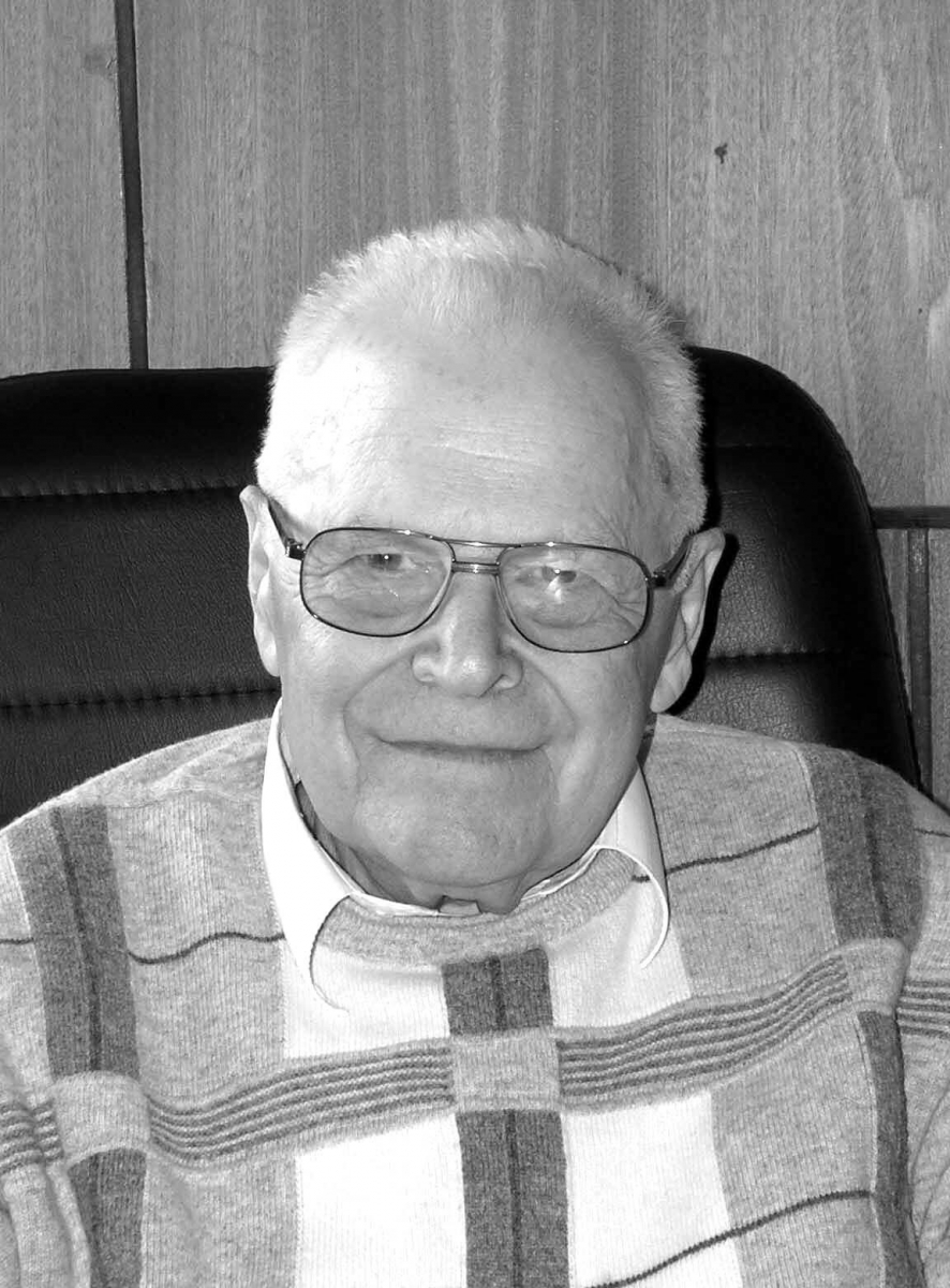
Eduard A. Trakhtengerts, Founder and first Head of Laboratory No. 46 |
In 1967, a separate group headed by Eduard A. Trakhtengerts was established to elaborate the theory and methods of software development for automatic control systems. The group conducted theoretical research in the area, publishing several monographs and brochures, and carried out extensive practical works. Group members participated in implementing large projects such as the Sirena network, the GVS-100 hybrid computing complex, and others (E.A. Trakhtengerts, S.Ya. Vilenkin, L.N. Gorinovich, V.A. Pronina, and A.N. Taranova).
In 1973, the group was transformed into a laboratory headed by E.A. Trakhtengerts. Its main area of studies became the theory and methods for developing architecture and software for high-performance multiprocessor computing systems. The theoretical research resulted in two doctoral (E.A. Trakhtengerts and S.Ya. Vilenkin) and more than 20 candidate’s dissertations. The main practical result of the Laboratory in the 1970s–1980s was original software for high-performance multiprocessor computing systems (E.A. Trakhtengerts, L.N. Gorinovich, V.A. Pronina, A.V. Babichev, E.L. Kulida, and V.G. Lebedev).
During those years, employees of the Laboratory were repeatedly awarded various diplomas.
Since 1991, the Laboratory has been headed by Valentin G. Lebedev, Dr. Sci. (Eng.), one of Trakhtengerts’ students.
Since the early 1990s, the Laboratory has been studying the theory and methods for developing computer-based decision support systems.
Note the following practical works of those years: the development of computer-aided electrical equipment design systems for Tupolev Experimental Design Bureau (now PJSC “Tupolev”) (V.G. Lebedev, A.M. Miller, and M.Yu. Khojayants); participation in developing a decision support system for eliminating radiation exposure consequences (E.A. Trakhtengerts); the creation of a prototype decision support system for aircraft crew (V.G. Lebedev, E.L. Kulida, and I.P. Kryukova, jointly engineers from Ramenskoe Design and Engineering Bureau and the Gagarin Air Force Academy); the development of an automatic control system for a direct current electric furnace of silicon smelting at Zaporozhsk aluminum plant (V.A. Pronina, E.L. Kulida, and Z.N. Pekh, jointly with Laboratory No. 29); and other projects.
 |
|
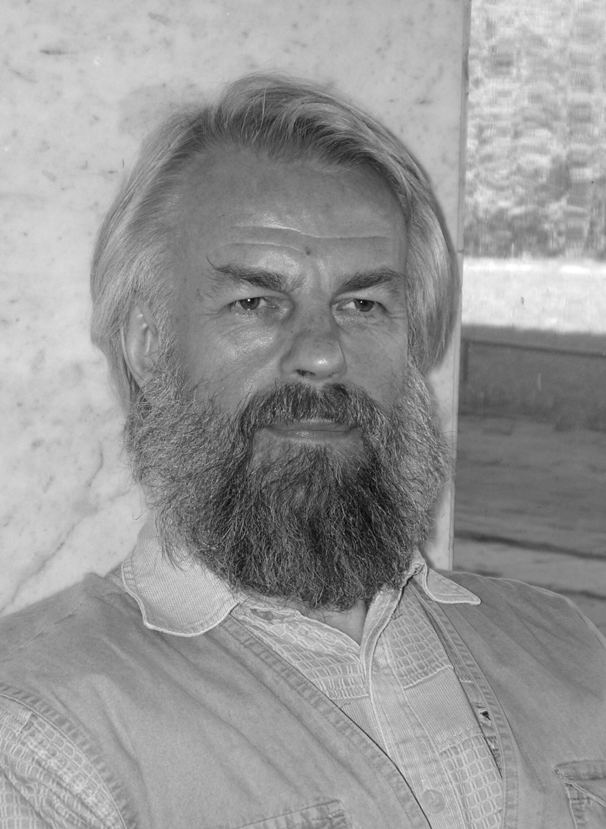
Valentin G. Lebedev |
In the late 1990s, employees of the Laboratory developed a graphical interactive approach for constructing software tools for modeling and system analysis. It was applied to design a high-performance digital signal processing processor for Nova Management Company, the USA (V.G. Lebedev, E.L. Kulida, and I.P. Kryukova).
The concept of infoware for operational decision support systems was developed and investigated. It consists in separating the information core of the system (information models of the control object and environment) and the functional part of the system (processing methods for the types of information models defined in the information core).
Within the Federal Target Program “Destruction of Chemical Stockpiles in the Russian Federation,” a methodology of building a data center on the ecological situation for high-risk facilities was developed and justified based on the principles of modern complex analysis of the ecological situation in the technogenic impact zone of a chemical weapon destruction facility. The functional, information, and hardware-software structure of the data center was proposed to develop a high-efficient and complex monitoring, evaluation, and forecasting system for environment changes with timely warning of critical situations. Information and analytical centers of industrial environmental monitoring systems were created at three chemical weapon destruction facilities (V.G. Lebedev, E.L. Kulida, and I.P. Kryukova, jointly with other laboratories of the Institute).
Within this Federal Target Program, employees of the Laboratory developed and studied a methodology for building computer-aided simulators. The simulators are intended to improve practical skills, involving operators in the operational control of a dynamically changing object in the normal and emergency modes.
 |
|
Georgy S. Veresnikov, Head of Laboratory No. 46 |
In recent years, an important area of the Laboratory’s research has been the development of methods, models, and algorithms to control moving objects under conflict in decision support systems for aircraft and underwater marine vehicle crews. A prototype real-time decision support system for underwater marine vehicle control was developed jointly with other Laboratories of the Institute. In the prototype, the trajectory and motion parameters of an underwater marine vehicle are optimized by a complex criterion considering various physical fields (E.L. Kulida, G.S. Veresnikov, and N.A. Egorov).
In 2020, the Laboratory was headed by Dr. Sci. (Eng.) Georgy S. Veresnikov.
Jointly with the Central Aerohydrodynamic Institute (TsAGI), an onboard model-based methodology was proposed for forecasting aircraft motion, detecting potential conflicts, and determining the implementability of conflict-resolving trajectories. As part of this work, methods and algorithms are being developed for low-altitude aircraft maneuver control in multicriteria, uncertainty, and risk conditions associated with complex terrain, weather factors, and air traffic (E.L. Kulida and N.A. Egorov).
Decision support methods and models for the preliminary design of aircraft under epistemic and mixed uncertainty were developed and tested. The results are intended to improve the efficiency of the long-term iterative design process requiring the computer-aided solution of the high-dimensional numerical and multicriteria optimization problems (G.S. Veresnikov, L.A. Pankova, and V.A. Pronina).
 |
|
Dmitry V. Tyukavkin |
In 2020, the Laboratory merged Laboratory No. 22 (Information Support of Moving Objects Control), founded in January 1998 by Dr. Sci. (Phys.–Math.), Prof. Dmitry V. Tyukavkin. He was a well-known mathematician in regular rings and much contributed to the establishment and further development of Laboratory no. 22. In 2004–2020, Laboratory No. 22 was headed by Dr. Sci. (Eng.), Prof. Alexander I. Alchinov.
Main scientific results of Laboratory No. 22
In the course of studies, the following results were obtained:
– A system was developed for the fast calculation and real-time visualization of the terrain model based on aerial survey data. The terrain model can be used for navigation and guidance of a moving vehicle, particularly in automatic mode:
- to reproduce the route traveled on the computer;
- to select the route and guide the vehicle when visualizing the terrain model using the moving vehicle model and to apply the resulting data for the moving vehicle;
- to navigate and guide the vehicle by comparing the terrain model calculated onboard with a predetermined model.
 |
|
Alexander I. Alchinov |
– Algorithms for interpolating a two-dimensional function over a set of values at given points based on a two-dimensional Kalman filter, which improve horizontal cross-sections compared to previously known methods.
– Automatic relief construction algorithms involving mutually oriented images. Note that a fundamentally new method was proposed to identify the corresponding points of two images. As a result, a high-reliable algorithm was created: it recognizes segments of little information (e.g., covered with water, snow, flat sand, etc.) and eliminates them from the relief base. (On such segments, the signal/noise ratio is small, and the arising interference may cause “outliers” or false surface identification.)
– Automatic methods for constructing admissible deformation domains of contour lines during map editing; automatic and high-reliable methods for placing hachures on the original relief; automatic methods for applying contour labels on the original relief and assigning marker positions for extended linear objects.
– A method for placing point objects with given upper and lower density boundaries.
– A terrain relief-form recognition algorithm based on contour lines only (without ground-level point objects).
– Methods for imaging parts of a broken line inside or outside a polygonal domain and boundaries of the domains obtained by applying logical operations to two polygonal domains; these methods improve image reliability.
– A coding automation interface to increase the accuracy of image coding results and reduce operator qualification requirements.
– A special storage format for the regular spatial data structure with possibly unlimited data storage, level data storage, fast access to each level’s data, and the ability to store data on an arbitrary-form domain. Hence, information can be acquired in real-time regardless of its volume and system complexity. Due to high speed, the data processing algorithm can be applied when developing new operational-tactical decision support systems.
– A technology for creating a multi-window stereo interface without special video controllers.
Applied results of Laboratory No. 22
– The results of studies were applied when creating a digital photogrammetric station (DPS). This station performs fast processing of aerospace survey data with subsequent visualization in three-dimensional terrain models. The models are used to optimize flight control over complex terrain based on digital mapping data. Modern means of precision weapon delivery significantly utilize terrain specifics for their maximum stealth. Therefore, the entire theater of possible combat operations should be discretized considering automatic landform recognition.
– The DPS developed at the Institute is one of the world’s best software products in terms of functionality and the efficiency of processing large amounts of information (up to 264 points). The program provides a significant automation degree for photogrammetric processing and mapping. The DPS was further developed into a hardware-software complex for processing and displaying three-dimensional information. Hence, the functional capabilities of technological support of control processes were extended.
– New fast processing algorithms and methods are being developed for aerospace survey data with visualization of three-dimensional digital information about the terrain relief and texture of objects. The processing results are visualized in three-dimensional terrain models, which is of great interest in control problems.
– Currently, employees of Laboratory No. 22 (now, within Laboratory No. 46) are developing and studying flight support methods over terrain with complex topography based on digitized map data. New information technologies are being developed to create an optimal noise configuration using camouflage means that minimize the probability of crucial objects hitting (by distorting the visible picture in the object’s vicinity used by the opponent’s precision weapon guidance systems).
– The intensive development of geographic information technologies continues. New algorithms and engineering solutions are characterized by high speed and accuracy in three-dimensional image processing, significantly reducing labor and time costs when creating maps and plans for the information support of moving objects control.
– Scientific and technical foundations were laid for developing advanced computer-aided means of planning and conducting passive protection (camouflage) operations for stationary and mobile (civilian and military) objects against precision weapons in modern military operations, including the network-centric war models.
– Many coal mining companies are currently working (jointly with the Institute) to create a digital map base of their sites. As part of this work, the Laboratory recently improved methods and technologies for obtaining geospatial data using unmanned aerial vehicles (UAVs). The new technology for processing these data was implemented when creating and updating digital topographic maps and plans for the Siberian Coal Energy Company (SUEK).
– Studies were carried out on improving geospatial data acquisition technologies based on the Earth’s remote sensing methods and determining the structure and completeness of geospatial information for municipal authorities (administration of town-planning activities and land management of settlements).
– The existing software products implementing geographic information technologies in mining are classified by application:
- general-purpose mining systems;
- specialized mining programs;
- production management systems;
- production registration systems.
 |
|
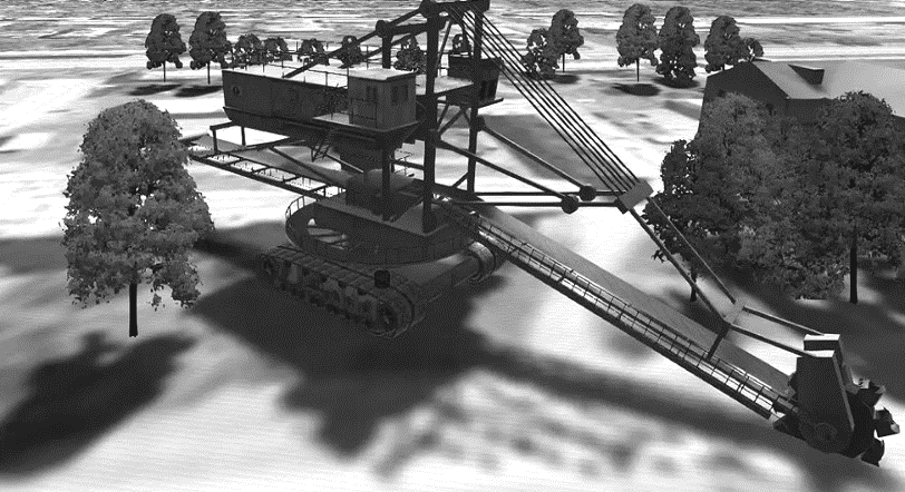
The 3D model of an excavator |
Dozens of companies offer over 1000 software products of various classes; however, there are no programs for the three-dimensional modeling of mining enterprises as the land and property complexes. Based on the analysis, employees of the Laboratory developed:
- theoretical foundations, algorithms, and a program for building three-dimensional models of the SUEK land and property complex;
- a 3D model of the land and property complex (LPC) of a coal mining enterprise.
The 3D model of the database of the LPC cartographic representation is intended for management tasks: planning and execution of mining plans, design and placement of infrastructure facilities, and use of licensed land plots, mining allotments, and real estate objects. Methods were developed to create 3D models of licensed land plots, mining allotments, plans of mining works, open-pit fields, and real estate objects in the SUEK territory. The 3D models are created, stored, and edited in the SUEK3D software system developed by the Laboratory.
 |
|
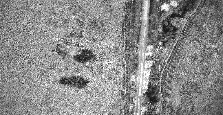
Access road to a coal opencast |
The SUEK3D software system was installed at SUEK enterprises. For example, in 2016–2017, 10 certificates on implementation were issued.
In April 2016, the Institute, the SUEK head office, and representatives of SUEK enterprises held a seminar in Minsk, where the SUEK3D software system was presented, and training sessions were organized. Specialists of coal mining enterprises are currently trained through webinars.
The technology described above yields 3D terrain models. They can be used to simulate low-altitude UAV flights over the terrain with buildings, large-sized equipment, and vegetation. The technology was tested on several coal opencasts to obtain high-quality aerial survey data.
A multi-window stereoscopic interface was developed in which the quality of stereoscopic visualization depends on the current configuration of the windows and the direction of the user’s gaze to save computing resources.
Most modern hardware and software systems have high requirements for keeping the horizontal plane of the user’s gaze (to avoid loss of the stereo effect). Therefore, when developing the software, a software mechanism was implemented to preserve the stereo effect under any inclination of the optical eye base. Thus, a fundamentally new approach was implemented to solve the stereo effect problem.
 |
|
Yuri D. Vorob'ev |
R&D Department No. 73 (Control Problems in Digital Cartography), created in October 2000 by Yu.D. Vorob’ev, contributes much to the development of geographic information systems (GISs) and their use in control problems. At present, the Department is headed by V.V. Kamenev.
 |
|
Vladimir V. Kamenev |
Employees of the Department are developing and implementing GIS NEVA to solve control problems. GIS NEVA is intended to create (update) and process vector, raster, and matrix maps and prepare them for publication by digital methods. The results serve as initial information for the subsequent printing of topographic, aerial, and nautical maps and city plans and electronic map database management systems.
GIS NEVA has the following functions:
- creating (updating) and processing vector maps using satellite and aerial survey data, circulation prints, and other sources;
- performing the digital compilation of topographic maps on a basic scale with subsequent preparation for publication;
- building three-dimensional terrain models for different applications;
- preparing vector maps for publication (printing) in accordance with current regulations or customer requirements;
- combining electronic topographic and nautical maps, e.g., for the coastal strip.
GIS NEVA is used in institutions and organizations of the Russian Ministry of Defense (Military Survey Agency of the General Staff, Navigation and Oceanography Agency, Aerospace Forces Staff), the Ministry of Home Affairs, The Federal Service for State Registrations, Cadastre and Cartography (Rosreestr), and Russian mobile operators and cartographic companies.
GIS NEVA was used to develop an integrated geographic information system for municipal authorities to expand the range of managerial tasks (urban planning and land relations) based on geospatial data methods and technologies with UAVs.
In 2006, the development, improvement, and use of miniature UAVs began. The peculiarity of UAVs is the possibility of autonomous flight along a predetermined route. In this case, the UAV independently performs an appropriate function (observation, photography, or examination of a given area).
The UAV complex includes a UAV with a removable payload module (a camera of minimum 12 MPx with photo and video modes) and a ground control and acquisition station (a secure laptop).
Several UAVs were supplied to the Rescue Service of the Yakutia Ministry of Emergency Situations. The Institute organized pilot training.
Based on GIS NEVA and modern UAVs, an interactive geographic information portal was implemented to monitor the state of the roads in the Moscow region. The quality of road repairs is assessed by comparing the digital aerial survey images before and after repairs.
Thus, Laboratory No. 46 has been performing scientific and practical activities for more than 50 years, carrying out fundamental research on the theory and methods of developing decision support systems and integrated information and control complexes.